About
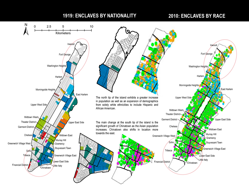
"Ethnicity Then and Now" is the product of an assigned, team-oriented, design research project. The purpose of the project was to apply our skills of mapping and design to address a site-related research inquiry developed by the respective teams. At the time of this project, the architects of my group were working on a project located in Manhattan, New York. As a result, it became an optimal study location for this project. During the inquiry brainstorming stage, we generated the following question: How have ethnic enclaves changed or not changed on the island of Manhattan from the early 1900s to today? We subsequently developed a methodology and produced a final product which compares two maps of the different times illustrating some of the changes and lack of changes.
Study Area: Manhattan, New York
TeamThis design research project was prepared under the supervision of Professor Blake Belanger.
|
DownloadsDownload the official document, 1919 map source, and the 2010 census data applied in this study via the buttons below.
|
Preview